ALBERT LIN – Lost Cities Revealed

Unlike the abundance of ‘soft’ documentaries to be found on satellite TV regarding marginalised and lost landscapes, Albert Lin’s professional credentials, combined with serious  academic research, and use of high tech equipment sets his work apart from the majority of sensation-driven content that floods TV channels currently. 

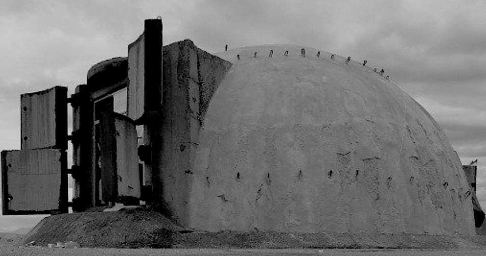
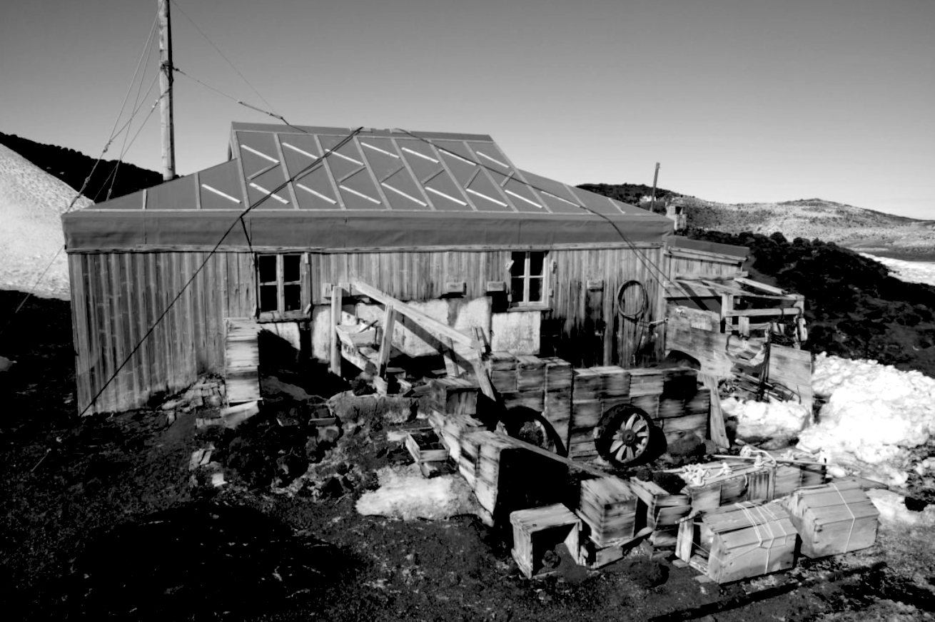
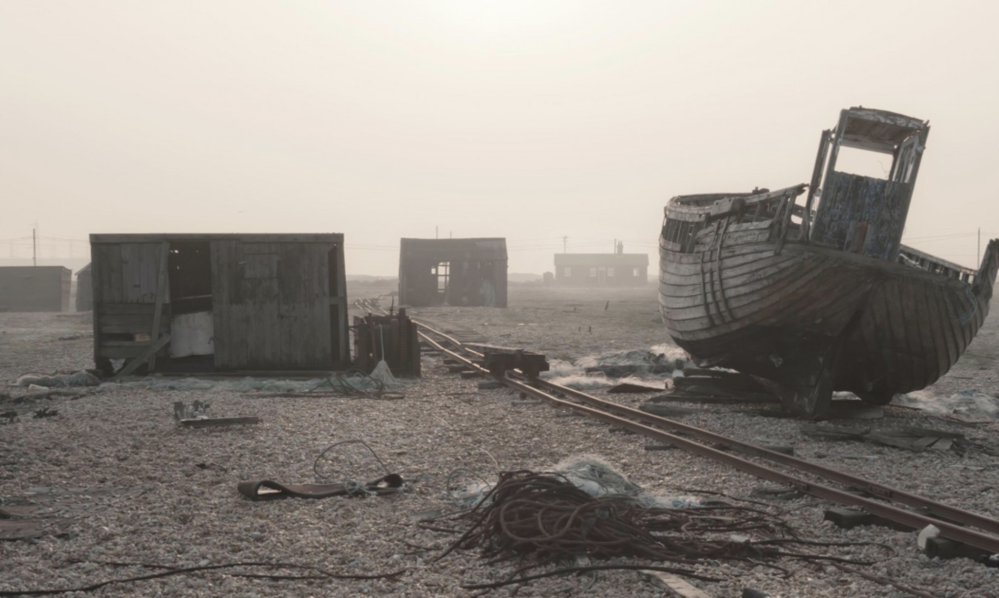
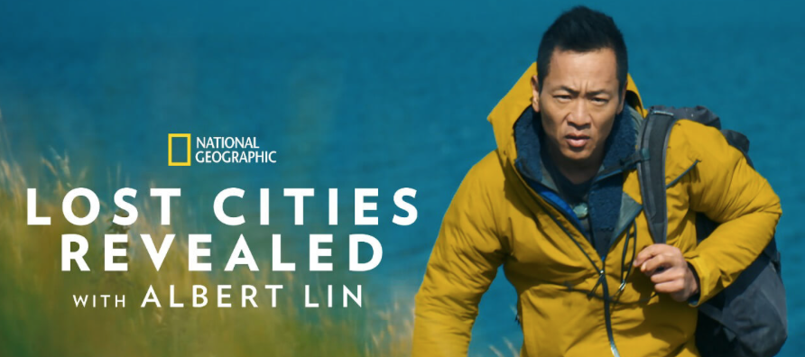
Here at AnMór Studio,  Lin’s work has become something of a touchstone for inspiration, and a mine of information, as well as confirming a genuine groundswell of interest in marginalised landscapes that further demonstrates our hunger for understanding and revealing threads of our past that have been lost to time. It is genuinely gratifying to know that both in terms of content, quality and format, Lin’s work will help to engage a growing international audience in a broader, and deeper conversation about fragments of our lost past. With the help of his dedicated teams of researchers, combined with the very latest in cutting edge imaging,  his work has shattered some of the assumptions that have been made around elements of past cultures, as well as encouraging historians and archaeologists, to rethink what was once enshrined in academic orthodoxy.   His most recent expeditions are chronicled in the new NatGeo documentary series, Lost Cities Revealed with Albert Lin, premiering in December.  The first episode, ”The Warrior King” follows Lin as he navigates a sacred mountain and a flooded tomb underneath a pyramid in the Sudanese desert, hunting for the lost capital of the Kingdom of Kush.

A California native, Lin holds a PhD in mechanical and aerospace engineering from the University of California, San Diego (UCSD). He subsequently founded UCSD’s Center for Human Frontiers, which focuses on harnessing technology to augment human potential. So it’s not surprising that he first made a name for himself by combining satellites, aerial remote sensing (drones), and Lidar mapping with more traditional ground exploration to hunt for the missing tomb of Genghis Khan in 2009.

The Valley of the Khans Project also successfully employed crowdsourcing (via more than 10,000 online volunteers) to help analyse the resulting satellite and aerial photography images, looking for unusual features across the vast landscape. That led to the confirmation of 55 archaeological sites in the region, a 2011 NatGeo documentary,  and a 2014 scientific paper detailing the benefits of so-called “collective reasoning” to archaeology

Losing part of his leg didn’t keep Lin from continuing to pursue an active, exciting life, thanks to a high-tech prosthetic. He is still out in the field, searching for answers, while continuing to host numerous TV documentaries for National Geographic detailing his various expeditions, such as Lost Treasures of the Maya in 2018 and 2019’s Buried Secrets of the Bible. Lost Cities with Albert Lin debuted in 2019, featuring Lin’s efforts to locate the former headquarters of the Knights Templar in Acre, Israel, and the fabled city of El Dorado in the Columbian jungle, as well as exploring an archaeological site in the Peruvian Andes and the Black Mead mesolithic site near Stonehenge.

In addition to hunting for the lost capital of Kush, the latest series of Lost Cities documents Lin as he searches for an ancient lost Maya city that was once home to the people who built the great pyramid city of Palenque; visits the mountains of Peru to search for the lost Chachapoya kingdom that predated the Incas; visits Scotland to learn more about the lost kingdom of barbarian insurgents known as the Picts; searches in Israel for the lost city of the Canaanites; and hunts for a forgotten Bronze Age Arabian civilization (the Land of Magan) in Oman. 

Needless to say, much of the content and ambition of Lin’s work resonates with the aims and intentions of AnMór Studio, and we hope in some small way to nurture a growing hunger for fresh interpretations and innovative ways to reveal the threads of our lost or forgotten past.  In a recent interview, Lin discussed in depth, his motivation and gave some insight into how the newest branch of his work has given him a deeper understanding of our ancient past.

“This last season put us right at the edge of life and death multiple times, and yet it felt like there was a deeper purpose,” Lin says. “Every time we made a discovery, every time we found a body up high on the cliffs or the remains of some ancient city buried in the sands, it felt truly like we were on this important mission to try to unlock the secrets of who we are. So this is much more than a TV show for me.”

AT: Was it a different experience for you this time around, shooting another instalment of Lost Cities?

Albert Lin: There were a couple of things. One is that we’ve upped the ambition when it comes to the scale of things we’re searching for. That meant more time with the research and planning, more time with our technology out in the field. Let’s bring all the tools, whatever we can get. So we have a lot more Lidar, a lot more ground-penetrating radar, and a much bigger visualisation suite—how we re-create the worlds that we’ve scanned once we find them.

But on a more existential level, these six episodes, it feels like they’re more than just looking for footprints of cities or bricks of an ancient building. They seem to be tapping more into the deeper questions of how we organise ourselves in different civilisations. Each city is basically, in my mind, an experiment, a rise and fall, a chapter. In these six episodes, you really get a sense that each one of them reveals something about humanity, whether it’s about our resilience or about how we have succeeded when we’ve worked together with a globalisation approach, or what we’ve done in the past when we’ve worked together in non-hierarchical societies. It gets into a much deeper level of thinking for me.

You spend a whole career going off into far parts of the world, and you think somehow that maybe one day, it’ll all become normal. But this season, everything just was so intense and so real. The stakes were so high. We had so many moments where we almost almost died multiple times. We got lost in the river and a couple of guys almost drowned; we lost a lot of cameras; we got flash-bombed and tear-gassed, but the whole time it was like, we’ve got to keep going. It’s just felt so purpose-driven.

They took us out on these waters following these ancient glyphs inside the tomb of [Mayan ruler] Pakal, and sure enough, we found this massive mountain that “breathed” every time the wind and the lake system filled its belly with air. When we did all the Lidar scans, we realised that the whole mountain was terraformed into a massive pyramid. And when we descended into the heart of that mountain, we ended up finding all this pottery from the very earliest days of the Maya.

AT: I love the idea of a mountain breathing. Many people don’t realise that the entire Earth “breathes”—truly a living planet.

Albert Lin: I’ve seen how dynamic the natural world is, as well as the way in which humanity emerges from that dynamism. Being this close to the origin of the Maya, and then being in this jungle and seeing the whole breadth of their story, it really feels like I’m looking at one version of humanity, the one that comes out of the jungle. On another expedition, we were down in the deserts of Sudan along the Nile River. You’re in the heart of this ancient world that was erased from the history books by the people who came next, but you still see this deeply existential aspect of our humanity.

You find all these pyramids down there that are tied to some orientation of the sun, and you watch the sunset on top of a pyramid, and it lands right over the edge of this sacred mountain in the distance. You travel to the sacred mountain and find a temple to a moon, the Creator God, and then you find what might be a capital city. Looking at the sunrise and sunset across all these civilisations, it just reveals something about our humanity, these little magical bits that I feel like we’ve lost or we’ve forgotten. The journey that this has been for me, i’s just starting now to really reveal the depth of the story that’s emerging. What is humanity? I think that comes out more in this season.

AT:  You’ve spent decades at this point getting a broad view of many different ancient cultures and civilisations. Perhaps you’re starting to see how it all links together, picking up on some universal truths about humanity and how we organise ourselves.

Albert Lin: You couldn’t have said it better. I’ve started marking this big wall poster in my office of all the timelines that I’ve bumped into. You see these emergent moments: here’s this technology that emerged or here’s this thing happened, and they seem disparate. But now, having encountered so many indigenous cultures, as well as the living descendants, you see these connections across all of them. It’s very humbling because it makes you feel like you’re part of a much bigger story. We’re, right now, on the final page that’s been written so far in this long history book of us. It feels like this universal human spirituality that exists across all cultures, and the struggles that we’ve always faced. We’ve been through mega 100-year-long droughts, we’ve dealt with the rise and fall of civilisations due to what was then considered global conflict. We’ve seen it all, we’ve done it all, and we’re continuing to do more. There’s just so many echoes. I feel like now, I’m starting to hear the echoes.

AT: You’re known for bringing cutting-edge tools such as Lidar to the field of archaeology. But you’re not just taking scans, you’re finding ways to re-create what things likely looked like, helping people who are not specialists get a very real sense of these civilisations.

Albert Lin: I think of Lidar as a new tool that came on the scene, like the microscope or a telescope. It’s like, oh my gosh, now you can see everything, but you’ve still got to make sense of it all. For archeology, the first part is trying to see the hints with the Lidar, and then working with the archeologists who have dedicated their lives to interpreting the stones on the ground. We bushwhack in with machetes and snake gators and trowels. You end up getting down to the ground level, even picking up a piece of pottery.

You can tell certain things in the pottery, how old the site might be or the ways in which they created art. But then you put your hand across the thumbprint that’s in the pottery itself, and you feel the humanity locked in time, 2,000 years buried in the ground. You put yourself in the place of the person who placed it there, and you start to get a sense of why someone did that. It’s almost like you hear their poetry. It becomes so much deeper than some typographical model of the archeological site. It becomes this window into a shared humanity that expands your own being. All the technology we bring, it’s great. But the real thing I’m seeking is that feeling. We spent a lot more time in this new season with the VFX and the reconstructions to try and rebuild that ancient world in a way that makes you feel it.

We had this moment in the jungles of Mexico, early Maya stuff that has never really been seen before in terms of the style—these three-sided pyramids. You lay it all out on the map across this lake system and they’re all in some alignment. Why are they all pointed in this one direction? We modelled the course of the sun over different times of year through antiquity, but we couldn’t figure out the source of an alignment. On the very last day of the shoot, the lead archaeologist says, “Try August 15th.” We plugged it in and realised, oh my god, the whole thing is aligned to this one date on the calendar. August 15th is the origin day, it’s the first day of the Maya calendar. I found that wildly profound.

AT: What is next for you? 

Albert Lin: That’s a good question. I think this last season was so intense that I am taking a minute to finish writing a book. I just spent a lot of time with a group of thinkers about the future of humanity and this divergent moment with AI. I feel like there’s answers to this existential moment that we face where we’re looking at cultural evolution and the evolution of technology. What is it that we’re afraid of losing? It’s because we sense that there’s some competition between the evolution of that thing, whatever it becomes, and the evolution of our culture. Then the question is, well, what is the essence of our culture? What is humanity? What is this thing that we’re afraid of losing?

I’m starting to see these broader connections across humanity. In my own body, I’m physically always feeling like I’m stepping one part in the future, one part in the past. I feel like the answers to these kinds of questions are tied to some of the earliest awakenings of our human consciousness. I’ve seen rock art all around the world that looks almost identical. I see symbolism in the ancient Maya that you see all over the world. It feels like if we’re going to worry about where we’re going, maybe it’s critical that we really understand where we came from at the origins.

The new season of Lost Cities Revealed with Albert Lin premieres on National Geographic Channel and is also available for streaming on Hulu/Disney+ on November 23, 2023. Interview sourced from Arstechnica. 

SITE, SEAL, GESTURE

THE WORK OF ARTISTS LIA WEI & RUPERT GRIFFITHS

Words | Rupert Griffiths

Our project will trace a series of itineraries between defensive structures built, re-used and abandoned along the Thames estuary over the last 300 years. Our sites are peppered along a route stretching from the concrete barges of Rainham Marshes along the Essex coast and to the military research base at Orford Ness on the Suffolk coast, now a nature conservation area. On the south side of the Thames, we jump between sites in Kent, from Cliffe to the Isle of Grain, the Isle of Sheppey to the Maunsell Sea Forts.

BW_MG_2742

Our duo walks the limit between land and water and where the river meets sea, dwelling at sites where successive human intervention has accumulated several layers of defensive architectures. From our disciplinary perspectives of archaeology, human geography and architecture and through our artistic practice, we re-inhabit these ruins in order to re-imagine the original intentions of their builders. The recorded sites, collected objects and chosen itineraries are the building blocks for our own production of photographs, artefacts and maps.

We re-configure these defensive/war architectures as sites of contestation and porosity, now invaded and overcome by entropy. In the gap or slippage between their past uses and present abandonment, we physically and imaginatively insert ourselves. These sites offer an openness to interpretation which encapsulates human memory and the experience of the environment at a given time but equally allows multiple parallel histories to be created and written over them. We play with the materiality of site, taking the solidity of stone and concrete and re-presence the absences that once inscribed them. Our aim however is that what is re-presenced is wilfully fictional, playfully asking questions about materiality, memory and history, and how constructed notions of nature and culture might be dissolved and re-imagined.

BW_MG_5601

Site

Our sites are defensive architectures along the Thames Estuary and south east coast. These obsolete and abandoned forts, bunkers and early warning systems are for us detached from signification, forms that are available as the raw material for an interpretative approach to architecture, dwelling and landscape. Located at the margin between land and sea, in sandbanks, marshland and estuary, the solid materialities of stone, concrete and earth and the fluid, turbulent materialities of air, water and dust are caught between presence and absence.

Seal

We explore a concurrence of sign, body and materiality by borrowing the “Seal” from the field of Chinese art and archaeology. Seals bind literary production and language to matter and the body. In visual terms, seals create a matrix of correspondences (or a chain of inversions) between figure and ground. In material terms, seals function as a link running from stone to ink to paper. This way, they help us relate literary production and language to matter and the body, connecting experience to memory. Crucial to our collaboration, seals also function as a tally between people and between people and place.

Gesture

Our work acknowledges the ‘material turn’ as a shift from representation to process and technic, such as the embodied gestures entailed in our acts of exploration, documentation and co-creation. Through flow, collision and interruption we explore an unfolding relationship between body, material environment and the imaginaries of site and landscape. We develop a repertoire of gestures and tool use – adding, substracting, moulding, casting, printing, piercing, digging – through which our bodies respond and correspond to the material forms we find and the natural processes of erosion, ruination and wilding that fragment them. Emerging from the literal and the imaginary ground of earth, stone, concrete and dirt, our working process folds together body, site and landscape.

Rupert Griffiths will be expanding on his work and projects in ECHTRAI, Edition 4, due Spring / Summer 2024

THE ETHICS OF DUST

Back in the summer of 2016,  I was fortunate enough to pay a visit to Westminster Hall at the Palace of Westminster (a UNESCO world heritage site) to see The Ethics of Dust. Commissioned and produced by Artangel, the exhibition by architectural preservation expert, turned artist – Jorge Otero-Pailos consisted of a 50-meter long and 6–meter high latex cast of the east wall, manifested from a restoration process designed to remove surface pollution from the walls of the hall itself. By spraying and then gently peeling off latex, Otero-Pailos had given the Hall a kind of ‘chemical peel’. And, like all such cosmetic procedures, it had become renewed through an intensive cleanse – lifting over 900 years of accumulated dirt, dust, soot, and grime from the limestone wall. The resulting cast, embedded with this dirt, once suspended from the roof adjacent to the east wall, exudes an ethereal radiance, when backlit from strategically positioned spotlights

The Ethics of Dust suggests a subtle interplay between permanence and impermanence, absence and presence, and elements of the solid/fragile. These are qualities that could be said to characterise many heritage sites, but are made elegantly visible through Otero-Pailos’s site-based intervention of this relict imprint. The latex cast at first glance, appears solid. Yet this illusory perception is ruptured as the whole assemblage sways gently in a breeze blowing in from the entrance hall, and a distinct latex smell reminds us that this is not stone but a far more fragile and ephemeral substance. The waxen colour, the folds and creases in the cast, evoke ancient parchment. Like a hanging map, I find myself cognitively attempting to ‘decode’ the cast, trying to spot identifying features to match it to the original wall as I walk its length. This act, combined perhaps with the adoption of the focused vision of those tasked with this preservation project, reveals small details that otherwise may have remained overlooked: fine hairline cracks , pitted and patinated surfaces, and differently sized limestone blocks. Simultaneously this new conceptual wall also evokes shed skins, or the shrouds used to wrap and encase the recently deceased, or objects intended to remain private or sequestered. Such analogies – of emergence, protection, and way-finding – are especially apt for an artwork which, essentially, is the by- or waste-product of a conservation process used to ensure the future longevity of this heritage site.

Recent examples of digital scanning and 3D printing used in preservation to recreate heritage sites also come to mind when viewing The Ethics of Dust. For example, the replica of the Triumphant Arch from Palmyra (Syria) destroyed by Isis in October 2015, and reconstructed and installed in London’s Trafalgar Square at a later date. Yet Otero-Pailos’s cast was never intended to be an exact replica or a reconstruction, but is something entirely different. By lifting layers of embedded dust from the original wall, I find myself thinking of the palimpsest as the work removes and displays these layers as physical traces of past events and times. By putting the practices and processes of conservation on display, the dust functions as both a substance considered to pose a threat to the future durability of this heritage site, and yet is also re-positioned as heritage in itself. The accompanying catalogue presents the dust as a witness to past events, if not indeed actually produced by,and evidence of these events: ‘Westminster Hall dates back to 1099 and its limestone walls have held the dust, soot and dirt from events including the Great Smog of 1952 and the trials of Guy Fawkes in 1606 and King Charles I in 1649’ we are told. This ephemeral substance is exhibited as holding historic value, and (it is implied) by fixing the dust in latex traces of past events are made at least conceptually tangible.

By conceptualising dust as both a destructive pollutant and constitutive palimpsest trace of heritage, I suggest that this kind of intervention also foregrounds the reluctance to ‘let go’ in the realm of cultural heritage driven by a preference for ‘loss aversion’ . The dirt has been successfully removed. Yet it has not been discarded but exhibited as substance with a combined historical, and artistic value. A substance that, once removed from the stone, is unlikely in contemporary post-Clean Air Act (1956) Britain to return (or at least to the extent of past blackened industrial British cities).

AnMór Studio’s current and ongoing research into the processes of abandonment, erosion, and dereliction and their impact on human memory and objects of remembrance, shows how letting go of things sometimes creates new kinds of profusion – most notably, for example – information and documentation. Catalogue records for objects that are disposed or dispersed from collections are updated with information to document these decisions, record motivations, and provide evidence that appropriate processes were followed and due diligence taken. The dusty cast, like such catalogue records, may be viewed as a remnant or trace of specific heritage decisions and negotiations. A remnant that is retained and held onto, partly perhaps, as a procedure of care. Perhaps this work, by its very nature indicates legitimate alternatives to the demolition or erasure of heritage sites that no are no longer seen to have any cultural worth, yet deserve in some way to be recorded for posterity, and for the benefit of future generations. Recent developments in laser scanning demonstrate the ability and commitment of conservation-led organisations towards digitally preserving historic buildings for historic records in perpetuity, but in the context of his work, Otero-Pailos points the way to a more elegant and enduring methodology that has the ability to not only preserve, but also to create artefacts of enduring beauty that transcend more traditional notions of what constitutes a work of landscape art.

On entering the exhibition a security guard screening my bag rather wryly declared that I was only about to see some ‘dusty old sheets’. Dusty old sheets these may be. Yet sheets (as I hope this dispatch has shown) that I have found beautiful, intriguing, and ultimately provocative for the questions they raise about the processes and practices of cultural heritage.

AN EXPANDED VERSION OF THIS ARTICLE WILL APPEAR IN EDITION 4 OF ECHTRAI JOURNAL , DUE FOR PUBLICATION IN SPRING/ SUMMER 2024

Abandoned Cold War Arctic Listening Stations

Relatively unknown, even today,  is the war of espionage that took place in the polar Arctic, that legitimised the term – ‘Cold War ‘ as a historical truism. After the close of  World War 2 late into the 1940’s,  the high northern regions of the earth were known to be the closest point between the two major superpowers of the USA and the USSR (Union of Soviet Socialist Republics) .  As the ongoing Cold War escalated, both continents had recognised the strategic value in using the Arctic as a site for listening in on the opposition’s communications, as well as providing opportunities for providing early warning against possible nuclear attack – The USA set up the DEW (Distant Early Warning) lines, a network of highly covert radar and scanning outposts designed to intercept Russian communications and rapidly deploy defences and early warning operations . Senior U.S military strategists had long predicted that if a 3rd World War should ever break out, its strategic centre would be the North Pole, and as a result, the Arctic became the perfect location for both nations to engage in electronic eavesdropping and espionage. 

During the late 1950’s and early 1960’s, both superpowers realised the importance of the small floating islands of ice that drift around the arctic in long, circular patterns. These freshwater islands, calved from ancient glaciers were substantial  and stable enough in size and depth to become the location for covert listening stations, equipped with highly advanced acoustical instruments that were capable of eavesdropping on incoming signals from hostile submarines,  and armed with a range of antennae  and receivers that could intercept telecommunications from the other side. Personnel would be dropped in to these sites for up to a year at a time, often in treacherous and hostile weather conditions, and with meagre supplies. It was a precarious existence, and a perilous way to spy., but in terms of strategic intelligence, it was necessarily invaluable.  

Telecommunications reconnaissance, also popularly referred to as SIGINT, ( a contraction of the words Signals Intelligence,)  gained in importance as a defensive and early warning strategy, as well as a network for gathering and collating intelligence on oppositional planning and movements. The Arctic ‘Drift Stations’ were crucial in obtaining a strategic advantage for both sides. At one point , both Russia and the USA had stations on Big Diomede Island, and Little Diomede Island respectively, that were in such close proximity, that they became conjoined by an ice bridge. This also became a major disadvantage, as in the height of  winter, the weather conditions became too hostile for manned operations and both sides abandoned their islands, bringing all activity to a rapid halt. 

The Russians were the first to adopt the idea of drift stations, seeing them as ideal locations for scientific research into geophysical, climatic, and oceanographic processes, and the first station, NP-1 (North Pole-1) began operations in 1937.  It was only during the advent of the Cold War era, that ice stations were commissioned for military and ‘special operations’ usage. At the end of the Cold War, those stations that hadn’t been decommissioned and subsequently abandoned, allegedly reverted to their original designation as “research” sites, although due to the rapid shrinkage of ice floes caused by global warming, many stations have been deserted and left to dissolve into the ocean. There is a weight of opinion, albeit speculative, that the American NSA (National Security Agency)  CIA (Central Intelligence Agency) and certain western allies still maintain a foothold at unspecified Arctic locations, especially as political and strategic sensitivities have been heightened  over the  recent Russian invasion of Ukraine – many believe that what is publicly declared as  “research” at least partially constitutes intelligence gathering, comms monitoring, and potential espionage. More often than not, the intelligence community hides its operations under cover, yet in plain sight, and this possibility certainly cannot be discounted.

THIS CASE STUDY WILL BE PERIODICALLY UPDATED AS FRESH RESEARCH MATERIAL AND ASSOCIATED DOCUMENTS BECOME AVAILABLE AFTER DECLASSIFICATION BY THE US GOVERNMENT.  

Many of the abandoned sites have been dismantled or lost to the ice since the Cold War era, however, many sites have either been preserved in the ice, or continue with polar scientific research, or a mixture of research and ‘reconnaissance’ and intelligence gathering. A handful of sites remain Top Secret to this day, with notable sites used by the NSA as part of the North Warning System >

Alpha / Fletchers Island -T3

ALERT 

Project ICEWORM (Greenland tunnel network)

Icy Cape, Cold Bay, Storm Hills, Point Lonely, Hall Beach

BUNKER 599 – REPURPOSING MILITARY ARCHITECTURE

An extended version of this case study will appear in printed form in ECHTRAI JOURNAL, EDITION 4, due Spring/ Summer 2024

‘Bunker 599’ by Dutch firms Atelier de Lyon and Rietveld Landscape is a project which lays bare two secrets of the New Dutch Waterline (NDW), a military line of defence in use from 1815 until 1940 protecting the cities of Muiden, Utrecht, Vreeswijk and Gorinchem by means of intentional flooding. A seemingly indestructible bunker with monumental status is sliced open. the design thereby opens up the minuscule interior of one of NDW’s 700 bunkers, the insides of which are normally cut off from view completely. In addition, a long wooden boardwalk cuts through the extremely heavy construction. it leads visitors to a flooded area and to the footpaths of the adjacent natural reserve. the pier and the piles supporting it remind them that the water surrounding them is not caused by the removal of sand, but rather is a shallow water plain characteristic of the inundations in times of war. The sliced up bunker forms a publicly accessible attraction for visitors of the NDW. it is moreover visible from the A2 highway and can thus also be seen by tens of thousand of passers-by each day. The project is part of the overall strategy of the designers to make this unique part of dutch history accessible and tangible for a wide variety of visitors.

A bisected pillbox on the bank of a dyke opens a way through the sometimes impenetrable memories of war to a future of broader horizons..

It is not the most beautiful or obviously inspiring location in Holland, Europe, or the world, and yet the dot on the map at Culemborg where Bunker 599 broods alongside the lugubrious waters of the 13th-century Diefdijk, and faces the relentless mechanised roar of the Amsterdam-Maastricht motorway,is poignant, and oddly moving.

This reinforced-concrete bunker, erected in early 1940 as part of the Dutch defences against military invasion, has been split in two − cut through by steel wires like some giant, and untypically hard, Dutch cheese − and now acts as a framed viewpoint for passers-by who, stepping down from the roadway, pass through its mournful bulk out onto a wooden jetty, set between timber piles, to the very edge of the dijk, and a view across the motorway, electricity pylons and flat levels stretching away into an infinitely big sky.

There is no meaning here other than stopping to stare. Certainly, the remodelled Bunker 599 catches the eyes of walkers and cyclists. It is at once, or so it seems, a large-scale contemporary sculpture, or, perhaps − seen from a distance − some Neolithic standing stone. And just as those ancient and ineffable monuments draw us to them, as if magnetically, so this split concrete bunker, reconceived by Rietveld Landscape, with Atelier de Lyon, commands attention. 

A part of the poignancy lies in the fact that, like its many sibling bunkers, pillboxes and canal-side defences, Fort 599 did nothing to stop the Germans from invading Holland in May 1940 and occupying the country in a few days. For all its ingenuity, the extensive system of water defences built from the mid-17th century to 1940 was unable to hold up an enemy who simply bypassed it. German paratroopers were dropped in their thousands on the other side of the 85 kilometre long Dutch Waterline, while the Luftwaffe reduced much of Rotterdam to rubble, threatening the same treatment for Amsterdam and other key cities unless the Dutch surrendered. They had no choice. So, all the ingenuity that went into the creation of a vast waterworks designed to flood the eastern Netherlands and so hold back invasions by Spanish, French and German armies, was ultimately to no effect.

Even then, the defences were shored up again after the Second World War, as if they might restrain the might of the Soviet armed forces at the outbreak of a much-feared Third World War. Holland may have fought brilliantly against the Spanish in the 17th century, but − especially because of its flat geography − it was to be no match for the sheer might of Napoleon and, later, Adolf Hitler. And, yet, today, the trade borne by all those articulated lorries thundering along the A2 motorway in view of Bunker 599 is a symbol of a Europe at peace, of boundaries pushed aside, of infinite possibilities.

This, too, is something to contemplate while looking through the fissure Rietveld Landscape have excavated through the warless concrete bunker, out into that level economic playing field, that boundless sky.

TOWERS OF SILENCE

Dakhma, (Avestan: “tower of silence”), is a Parsi funerary tower erected on a hill for the disposal of the dead according to the Zoroastrian rite. Such towers are about 25 feet (8 m) high, built of brick or stone, and contain gratings on which the corpses are exposed. After vultures have picked the bones clean, they fall into a pit below, thereby fulfilling the injunction that a corpse must not suffer contact with either fire or earth.

This Zoroastrian practice for the disposal of the dead involves the exposure of the corpse to the agencies of weather, vultures, and other wild, scavenging animals.  This funerary practice of excarnation was enmeshed in Zoroastrian tradition, though it has become less common in recent times. As a result, there are a number of disused towers of silence, which no doubt have a mysterious and foreboding presence in the landscape around them.

The exposure of dead bodies to scavenging animals as recorded by the 5th century Greek writer Herodotus, was said to have been practiced by the Persians. It would be reasonable to date the Zoroastrian practice to this period, and quite possibly even further back in time. There is a rationale for this treatment of the dead. According to Zoroastrian belief, the four elements – fire, water, earth, and air, are sacred, and ought not to be polluted by the disposal of the dead. Cremation, for example, is believed to cause pollution to fire, air, and at times river water as well, while burial (without adequate lining of the grave) causes pollution to the earth and ground water.

In order to avoid polluting these elements, Zoroastrians resorted to other means of disposing their dead. The most notable of these is the exposure of the dead to scavenging animals, which is the idea behind the construction of the towers of silence. Incidentally, the English term of this structure has been attributed to Robert Murphy, a translator in the service of the British colonial government in India during the early 19th century.

At present, it is not entirely clear when the earliest of these structures were built. Nevertheless, the towers of silence that are in existence today may have the same or a similar construction to those used in the past. These towers were essentially raised platforms with three concentric circles within them. The bodies of men were arranged on the outer circle, those of women in the middle circle, and those of children in the inner circle. Provided that vultures are present in adequate numbers, the flesh might be completely stripped from the bones in less than half an hour.

After the body was stripped of its flesh, the remaining bones would be left to be dried and bleached by the sun. The stripping of the flesh and the drying of the bones are regarded as a purification process, after which the skeletal remains may be collected and deposited in an ossuary, which would be located within, or close to the tower. Alternatively, the bones might be placed in a central well, where, if the climate is sufficiently dry, they would naturally disintegrate into powder, thus completing a natural cycle of birth, death, and rebirth. 

Towers of silence can be found in Iran and in India, where Parsi communities exist. In Iran, towers of silence were in use until this funerary practice was banned by the government during the 1970s. In a report from 2015, it was written that India has a Parsi population of around 61,000. Of these, 45,000 live in Mumbai. Hence, it is in this city that several towers of silence may be found.

Unlike in Iran, the problem faced by the Parsi people of India is that of a depopulation of vultures. The decline in the vulture population was a result of the scavengers feeding on the carcasses of livestock that were given Diclofenac, a type of painkiller. This caused the vultures to suffer from irreversible kidney failure, causing their deaths. As a result, there were not enough vultures for the disposal of the dead.

While some in the Parsi community have decided to adopt other forms of funerary practices, such as burial or cremation, others are taking steps to maintain the tradition, for instance, by constructing aviaries, where vultures could live and breed near the towers of silence.

RADIOACTIVE RUSSIAN SITES

CASE STUDY

Priozersk (formally known as ‘Moscow 10’) and Kurchatov are ‘closed cities’, restricted military zones, concealed and not shown on maps until they were ‘discovered’ by Google Earth. Enlisted to the pursuits of science and war, the sites were used for the covert testing of atomic and long distance weapons.

Falsely claimed as uninhabited, the cities, along with nearby testing site ‘The Polygon’ set the stage for one of the most cynical experiments ever undertaken. Scientists watched and silently documented the horrifying effects of radiation and pollution on the local population and livestock.

The Semipalatinsk Test Site (Russian: Семипалатинск-21; Semipalatinsk-21), also known as “The Polygon“, was the primary testing venue for the Soviet Union’s nuclear weapons. It is located on the steppe in northeast Kazakhstan (in the former Kazakh SSR), south of the valley of the Irtysh River. The scientific buildings for the test site were located around 150 km (93 mi) west of the town of Semipalatinsk, later renamed Semey, near the border of East Kazakhstan Region and Pavlodar Region. Most of the nuclear tests taking place at various sites further to the west and the south, some as far as into Karagandy Region.

The Soviet Union conducted 456 nuclear tests at Semipalatinsk from 1949 until 1989 with little regard for their effect on the local people or environment. The full impact of radiation exposure was hidden for many years by Soviet authorities and has only come to light since the test site closed in 1991 . According to estimates from Kazakh experts, 1.5 million people were exposed to fallout over the years.

From 1996 to 2012, a secret joint operation of Kazakh, Russian, and American nuclear scientists and engineers secured the waste plutonium in the tunnels of the mountains.

Since its closure on 29 August 1991, the Semipalatinsk Test Site has become the best-researched nuclear testing site in the world, and the only one in the world open to the public year-round.

HISTORY

The site was selected in 1947 by Lavrentiy Beria, political head of the Soviet atomic bomb project. Beria falsely claimed the vast 18,000 km² steppe was “uninhabited”.  Gulag labour was employed to build the primitive test facilities, including the laboratory complex in the northeast corner on the southern bank of the Irtysh River. The first Soviet bomb test, Operation First Lightning, nicknamed Joe One by the Americans, was conducted in 1949 from a tower at the Semipalatinsk Test Site, scattering fallout on nearby villages, which Beria had neglected to evacuate.  The same area, “the experimental field”, a region 64 km (40 mi) west of Kurchatov city, was used for more than 100 subsequent above-ground weapons tests.

Later tests were moved to the Chagan River complex and nearby Balapan in the east of the STS, including the site of the Chagan test, which formed Chagan Lake. Once atmospheric tests were banned, testing was transferred to underground locations at Chagan, Murzhik in the west, and at the Degelen mountain complex in the south, which is riddled with boreholes and drifts for both subcritical and supercritical tests. After the closure of the Semipalatinsk labour camp, construction duties were performed by the 217th Separate Engineering and Mining Battalion, who later built the Baikonur Cosmodrome.

Between 1949 and the cessation of atomic testing in 1989, 456 explosions were conducted at the STS, including 340 underground borehole and tunnel shots and 116 atmospheric, either air-drop or tower shots. The lab complex, still the administrative and scientific centre of the STS, was renamed Kurchatov City after Igor Kurchatov, leader of the initial Soviet nuclear programme. The location of Kurchatov city has been typically shown on various maps as “Konechnaya”, the name of the train station, now Degelen, or “Moldary”, the name of the village that was later incorporated into the city.

The Semipalatinsk Complex was of acute interest to foreign governments during its operation, particularly during the phase when explosions were carried out above ground at the experimental field. Several U-2 overflights examined preparations and weapons effects, before being replaced with satellite reconnaissance. The US Defense Intelligence Agency is said to have been convinced that the Soviets had constructed an enormous beam weapon station at a small research station located on the testing site.

This smaller research station, known to the Department of Defense as PNUTS (Possible Nuclear Underground Test Site) and the CIA as URDF-3 (Unidentified Research and Development Facility-3) was of great interest to American observers. After the fall of the Soviet Union in 1991, it was discovered that the mysterious URDF-3 was tasked with researching a nuclear thermal rocket similar to the US’s NERVA.

The site was closed by the President of the Kazakh Soviet Socialist Republic Nursultan Nazarbayev on 29 August 1991.

The Soviet Union conducted its last tests in 1989.  After the Soviet Union collapsed in 1991, the site was neglected. Fissile material was left behind in mountain tunnels and bore holes, virtually unguarded and vulnerable to scavengers, rogue states, or potential terrorists. The secret cleanup of Semipalatinsk was made public in the 2010s.

After some of the tests, radioactive material remained on the now abandoned area, including significant amounts of plutonium. The risk that material might fall into the hands of scavengers or terrorists was considered one of the largest nuclear security threats since the collapse of the Soviet Union. The operation to address the problem involved, in part, pouring special concrete into test holes, to bind the waste plutonium. In other cases, horizontal mine test holes were sealed and the entrances covered over. Finally in October 2012, Kazakh, Russian, and American nuclear scientists and engineers celebrated the completion of a secret 17-year, $150 million operation to secure the plutonium in the tunnels of the mountains.

Large parts of the STS have opened up since 2014, and economic activity has resumed: mostly mining, but also agriculture and tourism. As with other areas affected by radioactivity, the lack of human interference has made the STS a haven for wildlife.

When the test site was closed, Kazakhstan was faced with the question of how to decontaminate the land and what to do with the military-industrial complex that remained on the territory of the test site.   

In order to solve this and other problems, the National Nuclear Center was founded in Kurchatov City. Employees of the Center conduct research and carried out ‘re-cultivation’, which requires the land to be plowed in such a way that the contaminated topsoil ends up on the bottom, and the uncontaminated soil rises to the surface.  

Curbing nuclear proliferation is the number one priority for Kazakhstan, which felt first-hand the impact of nuclear tests and voluntarily gave up its nuclear capacity. This country was one of the first CIS republics to join the Treaty on Non-Proliferation of Nuclear Weapons (NPT) and the Treaty on the Prohibition of Nuclear Weapons.  

Kazakhstan also came forward with a proposal to create the International Day against Nuclear Tests, to be observed in order to promote the dissemination of information about the consequences of such tests. August 29 is not only the date of the first test at Semipalatinsk; on this date in 1991 President Nursultan Nazarbayev signed the decree closing the test site, also known as the Polygon.     


EXCERPT FROM A REPORT BY THE INTERNATIONAL ATOMIC ENERGY AGENCY:

Various locations around the world are affected by residual radioactive material. Some of them are the result of past peaceful activities, while others result from military programmes, including the testing of nuclear weapons.

In the 1990s, there was growing international cooperation in assessing the radiological effects of past military nuclear activities. In many countries, attention has turned to assessing and, where necessary, remediating areas affected by residual radioactive materials from military activities. The IAEA [International Atomic Energy Agency] has been leading this effort of assessing former nuclear-weapon test sites. This article reports on preliminary radiological evaluations of the Semipalatinsk site in Kazakhstan, where the former Soviet Union conducted more than 400 nuclear tests over a forty year period.

THE SITE

The Republic of Kazakhstan is located immediately south of Russia, and west of China. Following World War II, the steppes of Kazakhstan became the first centre for nuclear weapons testing within the Soviet Union. The Semipalatinsk test site is a 19,000 km2 zone in the north- east of the country, 800 km north of the capital Almaty. The zone lies southwest of the Irtysh River which flows into Kazakhstan from China and which, for a short distance, forms part of the nuclear test site boundary.

During the period 1949-89 the former Soviet Union conducted about 460 nuclear weapons tests within the test site. They included explosions that were conducted on the surface or in the atmosphere. Five of these surface tests were not successful and resulted in the dispersion of plutonium in the environment. Starting in 1961, more than 300 test explosions were conducted underground. Thirteen of the underground tests resulted in release of radioactive gases to the atmosphere. (See table, below.)

The only on-site inhabitants during the testing programme were in the town of Kurchatov whose purpose was to service the site, and in the small settlements of Akzhar and Moldari along the northern edge of the site. Recently there has been a limited amount of resettlement within the area, mostly by semi-nomadic farmers and herders. The bulk of the local population is in settlements just outside the site border. The total population of these settlements is estimated to be 30,000 to 40,000 people.

IAEA MISSIONS

In May 1993, representatives of the Kazakhstan Government informed the IAEA of their concern about the radiological situation in Semipalatinsk and western areas. Subsequently, the Government of Kazakhstan requested the IAEA to provide assistance regarding the former test areas of Semipalatinsk and western Kazakhstan. The IAEA agreed to organize a study of the radiological situation in these areas. This commitment resulted in a series of activities to characterize and evaluate the radiological situation at the Semipalatinsk test site.

November 1993. The first IAEA mission was performed in November 1993. The objectives were to become familiar with the test site and provide guidance on future actions. The team was also asked to assist in strengthening the national infrastructure in the area of radiation protection, with emphasis on environmental monitoring.

The team traveled to the Semipalatinsk site and identified the most likely areas of radioactive contamination on the test site as well as off- site. It also performed limited radiation measurements and collected environmental samples at identified locations to assist in further defining the concerns and provide information as to future actions. The team also visited governmental laboratories to determine their capabilities for cooperative efforts and to locate existing radiological assessment data.

Based on the results of this first mission, IAEA officers met in March 1994 at Agency headquarters in Vienna with delegation from Kazakhstan. At this meeting, one topic of discussion was the concern about Semipalatinsk. In response to this concern, the IAEA agreed to establish, through its technical co- operation programme, a project to assist the Republic Kazakhstan in the radiological assessment of the Semipalatinsk test site.

July 1994. 

A second IAEA mission to the test site was conducted in July 1994. The objectives were to collect additional radiological data from in and around the site, collect and review existing data provided by Russian and Kazakh sources relevant to the radiological situation at the test site, and to perform a prreliminary assessment of the present and potential future doses to residents in the Semipalatinsk area.

The goal was to determine whether further radiological evaluation and assessment were warranted. Soil, vegetable and milk samples were collected and analyzed by gamma spectroscopy and radiochemical analysis to determine radionuclide concentrations. Experts from the team spent time talking to inhabitants in the surrounding farms and settlements for the purpose of gaining information on the local diet and customs relevant to the dose assessment.

Duration of testing

1949-62 / 1961-89

1965-80/ 1968/ 1965-89

Test Zone Geology

Sandstone

Granite, quartz-porphyry, syenite rock mountain massif

Alevrolite, porphyry, sandstones Argyllite

Alevrolite, sandstones, conglomerate

Number of tests

Surface: 26 Air: 87

In mine galleries: 215 In boreholes: 24
In boreholes: 2

In boreholes: 107

IAEA BULLETIN, 40/4/1998

A third mission was conducted in 1998 in compliance with a United Nations General Assembly Resolution (52/169M). In this mission an expert team intensively examined the consequences and needs arising from two generations of nuclear testing in the territory of what has been the Republic of Kazakhstan since 1991. The mission was composed of specialists from organizations and agencies of the United Nations including the IAEA, the Government of Kazakhstan, and other technical experts from the international community.  The mission was deployed from 15th – 30th June 1998 to carry out the needs assessment of the humanitarian situation in the Semipalatinsk Test Site Territory of Kazakhstan, as stipulated in the UN resolution.

FINDINGS OF THE MISSIONS

Based on information collected during the missions and subsequent research, there is sufficient evidence to indicate that most of the area has little or no residual radioactivity directly attributed to nuclear tests in Kazakhstan. There are a few areas that have elevated residual radioactivity levels within the test site where the surface tests were performed and where a few underground tests vented to the atmosphere. Preliminary surveys of these areas indicated that the contamination is relatively localised.

Due to the limited amount of survey data that was collected during the missions, the existence of actinide residues from the failed nuclear tests could not be corroborated. Descriptions of the nature of the failed tests, the prevailing conditions and any supporting data would be needed before further investigations are considered.

Currently there are no restrictions of access to the nuclear test site and limited reoccupation has already begun. An assessment of the exposure of persons who, on a daily base, visit the areas where the surface tests and vented underground explosions has been undertaken. Initial findings of this assessment indicate annual exposures in the region of 10 mSv, predominantly due to external exposure. If these areas were permanently settled in the future, estimated exposures could be up to 140 mSv per year. This annual exposure is above the action level at which intervention is expected to be undertaken. Remedial action is, therefore, considered necessary for these localized elevated areas. However, due to budgetary and other constraints, the most appropriate remedial action at this time may be to restrict access to these areas.

The measurements made by the IAEA experts corroborate, to a reasonable degree, the more extensive surveys carried out by different organizations from Kazakhstan and the former Soviet Union. The combined results are considered sufficient to form the basis of a preliminary assessment of the radiological situation of the area around the Semipalatinsk test site. The one exception to the above conclusion is the drinking water supply. While samples of drinking water taken during the missions showed no elevated levels of artificial radionuclides, sampling was not comprehensive. As such it is difficult to draw general conclusions about the entire water supply. In addition the results do not provide any guarantee about the future security of the water supply.

External dose rates. The external radiation dose rates and soil activity outside the test site are the same, or close to, typical levels in other regions and countries where no nuclear-weapons testing had been carried out. Some areas show small increases but these are not significant in terms of the exposure to the local population.

One village had a higher plutonium deposition level than the other settlements and has been the subject of more comprehensive soil sampling. However, estimated annual doses still remain low. Intervention to reduce the radiation exposure of people outside the Semipalatinsk test site is not considered to be justified.

this document will be revised and updated as new information becomes available.

ANI – Deserted City of Churches

Ani –  (Armenian: Անի; Greek: Ἄνιον, Ánion;  Latin: Abnicum; Turkish: Ani) –  is a ruined medieval Armenian city now situated in Turkey’s province of Kars, next to the closed border with Armenia.

Between 961 and 1045, it was the capital of the Bagratid Armenian kingdom that covered much of present-day Armenia and eastern Turkey. The iconic city was often referred to as the “City of 1,001 Churches,” though the number was significantly less. To date, 50 churches, 33 cave chapels and 20 chapels have been excavated by archaeologists and historians.

SOURCE: Wikipedia

Founded more than 1,600 years ago, Ani was situated on several trade routes, and grew to become a walled city of more than 100,000 residents by the 11th century. In the centuries that followed, Ani and the surrounding region were conquered hundreds of times — Byzantine emperors, Ottoman Turks, Armenians, nomadic Kurds, Georgians, and Russians claimed and reclaimed the area, repeatedly attacking and chasing out residents. By the 1300s, Ani was in steep decline, and it was completely abandoned by the 1700s. Rediscovered and romanticized in the 19th century, the city had a brief moment of fame, only to be closed off by World War I and the later events of the Armenian Genocide that left the region an empty, militarized no-man’s land. The ruins crumbled at the hands of many: looters, vandals, Turks who tried to eliminate Armenian history from the area, clumsy archaeological digs, well-intentioned people who made poor attempts at restoration, and Mother Nature herself. Restrictions on travel to Ani have eased in the past decade, allowing following photos to be taken.

ABANDONED ARCTIC STATIONS

For centuries, the most extreme scientists, explorers, fishermen, and travellers have called Antarctica home. If you are fortunate enough to visit this remotest of regions, you may have the chance to visit some of the research stations that pepper the continent, representing the valiant efforts of humankind to study the unknown. Over time, many of these stations have been abandoned and left to the elements for eternity.

Why abandon a station that you’ve invested so much time, money, and effort into? It’s no mystery that the harsh and trying conditions that characterize Antarctica can be challenging, even to the most rugged explorers. In some cases, there simply wasn’t enough money or resources to keep the station up and running anymore, sometimes the reasons became more political. Below, we explore five truly remarkable abandoned stations at the end of the earth.

During the early 20th century, Norwegian sea captain Carl Anton Larsen established a whaling and sealing station on the remote island of South Georgia. He chose this particular location after first visiting the island during the 1901-1903 Swedish Antarctic expedition. The waters were teeming with marine life, which provided the perfect opportunity to meet the high global demand for whale oil and products. With unrestricted whaling and fishing opportunities, Grytviken was the ideal place to set up shop.

The following 60 years of unsustainable hunting practices eventually took its toll on South Georgia’s marine mammal populations. By the mid 1960s, whales and seals had drastically declined to the point of complete disappearance. Soon, whalers at Grytviken found themselves with nothing left to fish out of the oceans and were faced with the reality of closing the station’s doors for good. There seemed no point in completely removing the station from the shores where it stood, especially since there was limited room on the ship back to Europe. Instead, the whalers left the station to the harsh Antarctic elements to sit for eternity.

Today, Grytviken remains preserved in near pristine condition and offers tourists an opportunity to step back into the early days of Antarctic exploration and establishment. There is very little about this deserted station that has changed since it was officially closed, except the addition of the South Georgia Museum, which comprehensively exhibits the history and significance of South Georgia Island during the turn of the century.

Grytviken, South Georgia © Erwin Vermeulen-Oceanwide Expeditions

The A. B. Dobrowolski station, located on the Australian side of Antarctica referred to as “Wilkes Land”, was originally established as ‘Bunger Oasis’ by the Soviet Union in 1956. Due to lack of sufficient funding, the Soviet Academy of Sciences handed over the research base to the Polish Academy of Sciences in 1959.

During the next 20 years, Polish researchers carried out research focusing on gravitational fields, star charting, climatic variation, and polar radiation levels. Like the Soviets, however, the Polish Academy of Sciences was faced with an extraordinarily high bill for air transport to and from the station, and an even higher cost of living while researchers were stationed at the base.

The last team to have officially visited the station for scientific purposes was some time between the 1960s and 1970s. Almost all of the original station remains standing to this day. The huts used to conduct research, dilapidated helicopter parts, and even the furniture and kitchen supplies inside the living quarters remains in tact and in perfect shape.

There are currently no future plans to reopen the station. The sister station to A.B. Dobrowolski, Henryk Arctowski, is located on King George Island in the western Antarctic Peninsula.

Despite being abandoned for nearly 25 years, Vladimir Lenin watches over the Pole of Inaccessibility station, located in Queen Maud Land. In 1958, Soviet scientists established a small, temporary base that was meant to briefly study the region’s glaciology, meteorology, and Earth magnetism. This region experiences the coldest recorded temperatures on earth, with winter lows reaching a chilly -72°F (-58.2°C), and is also the point in Antarctic furthest from any ocean.

In the dead of winter, the entire station is buried to the roof in snow. The only way to know of any kind of human existence is to look for the oddly placed plastic bust of Lenin. As the story goes, the Soviets wanted to specially commemorate their establishment of the station. Instead of a flag pole or a carefully crafted sign, they decided that a small statue of Lenin would do. To this day, Lenin patiently watches over the station, seemingly unsure of his comrades’ return.

In 1910, Robert Scott, Ernest Shackleton, and Roald Amundsen engaged in a race to see who could reach the South Pole first. Knowing the location of Shackleton’s now abandoned hut could have proven to be an advantageous stopover en route to the pole. Before the expedition began, however, Shackleton, Scott, and Amundsen kept a gentleman’s agreement to not use one another’s facilities in the process of reaching the South Pole.

Over a century later, treasures from Shackleton’s hut are still being discovered. In 2006, five crates of McKinlay and Co. whiskey were found buried beneath the hut. Analysis and restoration of the whiskey is currently underway at the Canterbury Museum in Christchurch, New Zealand. The result of these studies? Not even 100 years of hiding below a hut can damage a fine spirit.

Shackleton’s Hut, Cape Royds, Ross Sea © Delphine Aurès-Oceanwide Expeditions

In 1909, the race to the South Pole was on. Antarctic explorer heavyweights Ernest Shackleton, Roald Amundsen, and Robert Scott were in hot pursuit of the title of “first to reach the exact bottom of the world”. This title, however, was no simple trip with a dogsled. It was, in Scott’s experience, a trip with dogs, motor sledges, and ponies. The results were catastrophic. During the winter of 1911, Scott built a small hut for his crew of men on Ross Island to serve as a base of operations during the expedition.

By 1913, the Terra Nova Expedition was officially over. Amundsen had beaten Scott to the pole by a mere 34 days, and Scott was dead, freezing to death with a team of men less than 20 miles away from shelter. Nearly a year later, Ernest Shackleton made use of the abandoned hut during his Imperial Trans Arctic Expedition. Some of his supplies can still be found inside the hut.

From 1917 to 1956, the hut sat untouched by humans. When it was finally dug out by a team of American expeditioners, its contents were found to be in near pristine condition, thanks to the preserving power of sub zero temperatures. Today, the hut still stands strong on the northern shore of Cape Evans, marking the beginning and end of some of the most epic Antarctic expeditions.

A SENSE OF AWE

interview with visual artist, Zoe Taylor

Words | Baz Nichols 

It is early December 2022, and Echtrai Edition 2 is about to roll off the press and into the world. The stunning front cover imagery was generously provided by the landscape painter, Zoe Taylor, an artist who specialises in landscapes that are at once arresting and deeply rooted with a sense of place. Most of the images are densely layered, stratified and scarified, with an intensity of dramatic movement,  forces and cross-currents,  as if each work has been gestated in the midst of a raging storm, or some bleak, remote location far removed from humanity . In fact the human presence is never seen in her pictures, but rather there is an implied presence captured in the lines of these dramatic vignettes.  The image we commissioned for the cover is now a few years old, and Zoe’s latest works have evolved and developed further, yet perhaps with a more restrained approach and palette. 

Zoe has exhibited far and wide in the UK , but her work can mostly be encountered and purchased at galleries in and around her Midlands studio. I caught up with her to ask her about her work and inspiration: : 

BN: We met a few years back and collaborated on one of my developmental boxed poetry editions, The Land Incanted – back then I described your work as not being depictions of specific locations, but that they were evocations of a ‘generic non-place’ that comes from your imagination. Would you say that is an accurate description, or do you try to capture the essence of specific places and locations in your work? 

ZT: The inspiration always comes from specific locations but I am never looking to depict a single place in a final piece but seeking to evoke more the feeling of being in a location which could be felt in any similar place. 

BN:  The ‘mood’ of a piece seems to be a very important element in most of your works – does this mood come from within you, and relate to how you are feeling at the time of painting, or is this a distinct and separate mood created just for the painting itself? 

ZT: The ‘mood’ is my natural self when in these landscapes so very much from within me. I am naturally drawn to lost landscapes, places far from the pathway, abandoned. A sense of awe when a vast open vista lies before me with what can sometimes be epic skies to accompany the view.

BN: Place is obviously very important to you and your work – can you name the places that inspire you most,  or those which perhaps have eventually made an impact on your work? 

ZT: Having spent many, many years travelling from the Midlands to west Wales, The Black Mountains are always a huge draw for inspiration. It is usually large flat areas of land that I really love. Any moorland area is always a place I would return to. 

In 2021, my photographer husband Nik Taylor and I, produced a body of work based on post industrial sites for a joint exhibition Gallery at Home in Usk. This was a first for me in that I don’t usually produce any site specific work.

We investigated two sites known to us. One was Titterstone Clee Hill in the Shropshire Hills AONB, the summit of which is mostly affected by man-made activity from the Bronze and Iron Ages and more recently by years of mining for coal and quarrying for dolerite, known locally as ‘dhustone’

Our second choice was The Blorenge, a hill which sits between the towns of Abergavenny and Blaenavon in South East Wales. and is a SSSI. This is a richly layered hill which has Limestone, Sandstone and Ironstone showing evidence of mining for all. The view from the top of this hill is 360 degrees and it is an amazing place. A place that I think we will return to again and again.

BN: In terms of the evolution of your work, what has changed the most in the way you approach a painting? Is technique an important factor, or do places themselves feed into your imagination? 

ZT: Materials can be a huge factor for me in how I create my work. Originally working with acrylic on paper, I made the move to oils on board. After only working in oils for around 4 years, I developed a problem in using solvents and had to step right away from oil paint and back to acrylics. Techniques between the two types of paint have to be taken into consideration. Both are wonderful in their different ways but the approach has to be slightly different. 

I am now working to a much larger scale and on canvas – something that I never thought I would get along with, but it’s all about what suits the work that you are doing best. 

Painting for me is all about mark making and problem solving.  As a painter there is something you are wishing to portray and then you need to work out the best way of interpreting that. 

My work constantly evolves and at the current time, I am again working on a slightly different path.

BN: Your latest works have a great deal of ‘white space’ in them, and the colour and form a lot more restrained and muted – does minimalism play a part in this as a deciding factor, or does something else altogether  help you decide on how to construct an image? 

ZT: My natural tendency is to use a muted palette. This year I have been exploring a more minimal image. I’m not really wanting to make what might be considered a properly constructed composition, with a road leading in or a line of trees to take you to the view point. Again it is that feeling of being up in those high places that I love and I feel these constructions are of less importance to convey that. 

My first love is always abstract work – something that I have never found to be quite the right fit for me as I need something to hang my work on but I do continue to push my boundaries a little. 

BN: How important are your sketchbook representations to a final work? For many artists the sketchbook appears to give an approximate idea of final form – do you use sketchbooks to aid in remembering a particular place, or do you use it to test ideas, shape, colour and and then form? 

ZT: My sketchbook work has never really informed a final piece directly. It is more of an aide memoir to a scene to just give indication of space and place. A lot of intuition and response to mark goes into my work and there has never been a slavish response to a sketchbook.

During the second half of 2022 I have taken some time out. Over the past 6 years I have produced work for one or two solo exhibitions every year. It has been a lot of work and I felt that I needed time to step away and to explore my process and interests. 

This has taken me back to small experimental works on paper which I have really enjoyed. It may be that I return to my beloved landscapes with a renewed outlook or it may be that my work takes a step sideways. I will be making some larger scale work soon and will see how that goes. 

Your comfort zone is always something you should try and escape from occasionally !

Examples of Zoe’s work, alongside contact and purchasing details can be found at her website: zoe taylor.me